Use case · Itinerary
The cycling route planner
for riding together
A cycle touring holiday, a weekend loop or a club ride: the stages on the map, the distance and time of every leg, the climbs, and a GPX file for the road.
What a shared cycle route changes
One route for every rider, ready to load onto a GPS.
- 📍
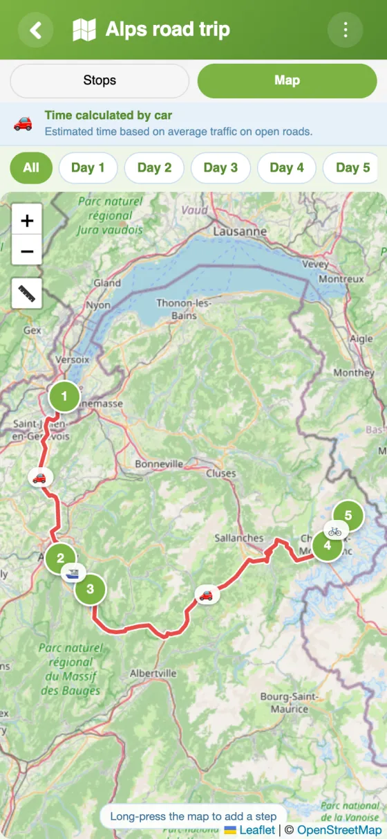
Stages on the map
A village, a mountain pass, a station: find each stop with a search or a long press on the map.
- 📅
The tour day by day
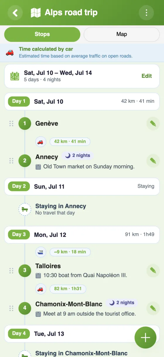
Departure date and nights at each stop: the app splits the route into days, with each day's distance.
- ⛰️
Elevation for every leg
An elevation profile shows the climbs on cycling legs, so you can pace the days.
- ⏱️
Estimated riding times
By bike, time is worked out at around 20 km/h, following roads and paths.
- 📤
GPX export
The whole route goes out as a GPX file for your GPS or bike computer.
- 🚆
Bike and train in one plan
A train home or a ferry crossing: each leg can have its own transport mode.
Your cycle route in YouTim
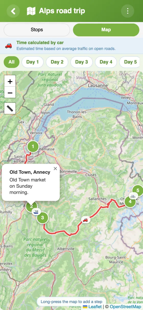
The stages with their distances, the route on the map and the details of each stop.
Plan your bike route in 5 minutes
A bike route builder for riding as a group
On a bike trip, the route is planned together but everyone rides with their own phone or bike computer. YouTim's Itinerary service keeps one route for the whole group, from the first pedal stroke to the last stage.
Plan my bike route: a day ride or a multi-day tour
For a day ride, a handful of stops is enough: start, lunch, a viewpoint, home. For a tour, the by-day option sorts the stops from the departure date and the nights at each one, and shows how far you ride each day. On the map, one chip per day shows only that day's legs.
A cycle routes map the whole group can read
Between two stops, the cycling leg follows roads and paths. To stick to a particular cycle path or greenway, add more stops along it, so each leg stays short and easy to check. The elevation profile shows where the road climbs, which helps decide where to regroup.
A bike trip planner for long-distance routes
A EuroVelo section, a stretch of the National Cycle Network, a coast-to-coast ride: note the overnight towns, the nights there and a note at each stop (meeting time, water point, a station to bail out to). On an e-bike, the 20 km/h basis gives a fair idea of time in the saddle; adjust the plan to your own pace.
Coming home by train? Add that last leg in train mode, and the trip summary splits the kilometres ridden from those travelled by rail.
A free cycle route planner with GPX export
Once the route is ready, export it as a GPX file and load it onto your GPS, bike computer or navigation app. It can still be changed in YouTim before and during the ride, and members are notified when a stop is added or removed.
Riding with the same friends every weekend? See our YouTim for friends page for the chat, calendar and costs that go with it.
Frequently asked questions
Is the YouTim cycling route planner free?
Yes, completely free, with no ads and no in-app purchases, on iPhone, Android and the web.
How is riding time calculated?
The route follows roads and paths, and time is estimated at around 20 km/h. It's a guide: adjust for the climbs and your own pace.
Can I see the elevation of a stage?
Yes: for cycling and walking legs, an elevation profile shows the ups and downs.
Can I load the route onto a GPS or bike computer?
Yes, the route exports as a GPX file, which most GPS units and navigation apps can read.
Can everyone in the group change the stops?
By default, yes: every member can add, edit or reorder stops. An admin can keep this for admins only, or lock the itinerary.
Can I share the route with someone without an account?
Yes. An admin turns on “Share as view-only” and sends the link: the person sees the stops and the map in a browser, without being able to change anything.
 YouTim
Your whole group in one place.