Use case · Itinerary
The road trip planner
everyone in the car can follow
Stops on the map, nights at each one, a day-by-day plan and the distance of every leg: one road trip, shared with everyone travelling.
What a shared road trip planner changes
One plan for every traveller, easy to change on the way.
- 📍
Stops in the right order
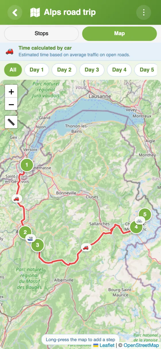
Search for a place or long-press the map, then drag the stops into the order you want to drive them.
- 📅
A day-by-day plan
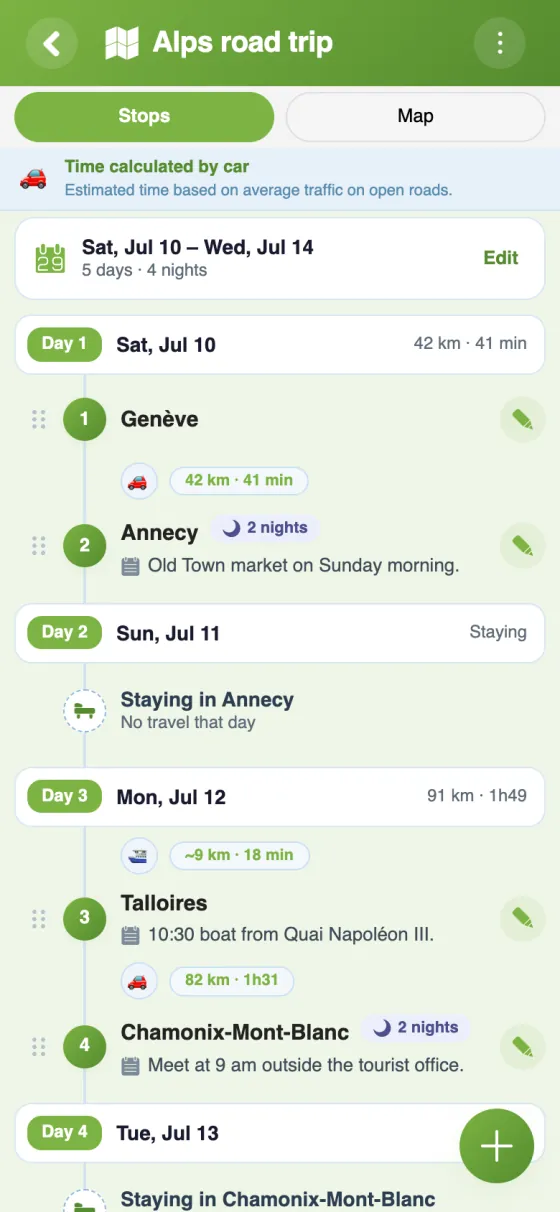
Set the departure date and the nights at each stop: the app lays the trip out day by day, with dates.
- 🗺️
One day at a time on the map
A chip per day shows only that day's legs, so tomorrow's drive is clear at a glance.
- 📏
Distances and driving times
Each leg shows its distance and duration, and the summary adds up the whole trip, days and nights included.
- ⛴️
Car, ferry, train or plane
A ferry crossing or a flight home sits in the same plan, each leg in the colour of its transport mode.
- 📝
A note at each stop
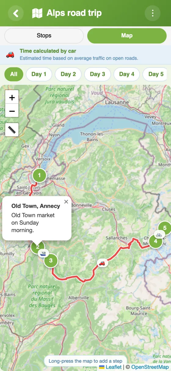
A meeting time, a viewpoint, the café someone recommended: up to 500 characters, visible to everyone.
Your road trip in YouTim
The stops with their distances, the route on the map and the details of each stop.
Plan your road trip in 5 minutes
A road trip planner made for travelling together
A road trip plan usually ends up scattered across messages and screenshots. In YouTim, the route lives in one place that every traveller can open and change.
A free road trip planner app, with no ads
The Itinerary service is free, with no ads and no in-app purchases. It runs on iPhone, Android and in any browser: the planner on a laptop and the passenger on a phone see the same trip.
A road trip planner with stops and nights
Ten days, five towns, two nights by the sea: add each stop and the number of nights there, and the planner works out which day you arrive and which day you leave. Members are notified when a stop is added or removed.
A longer journey, such as a cross-country road trip or a classic American route, works the same way: the plan simply has more days.
Road trip mapper and calculator: distances, times and totals
For car legs, distances and durations follow the roads. The summary at the bottom of the list gives the total distance and driving time, the days and nights and, if you mix car, ferry and train, a breakdown by mode. For turn-by-turn directions, keep your usual navigation app, or export the route as a GPX file for a GPS. To share fuel and tolls, add the Budget service to the same YouTim.
Things to carry on a road trip
Driving licence, insurance papers, chargers, a first-aid kit, water, snacks, a paper map for areas with no signal. Put it all in a shared Lists service and each traveller ticks off what's packed.
Choosing the best road trip planner for a group
The best road trip app is the one everyone actually opens. Here the itinerary sits in the same private YouTim as the group chat and the budget, with no link to forward when the plan changes. For the whole trip, see our group trip planner page.
Frequently asked questions
Is the YouTim road trip planner free?
Yes, completely free, with no ads and no in-app purchases, on iPhone, Android and the web.
Can I plan a road trip with stops over several days?
Yes. Turn on “Organise the trip by day”, set the departure date and the nights at each stop: the stops are sorted by day, with dates and each day's distance.
Does it work out distances and driving times?
Yes. For the car, distances and durations follow the roads. Each leg shows them, and the summary gives the totals for the whole trip.
Can everyone in the group change the route?
By default, every member can add, edit or reorder stops. An admin can keep this for admins only, or lock the itinerary.
Can I mix the car with a ferry or a train?
Yes: each leg can have its own mode. For train, boat and plane, distances and times are estimated as the crow flies.
Can I show the route to someone who isn't coming?
Yes. An admin turns on “Share as view-only” and sends the link: the person sees the stops and the map in a browser, without an account, and can't change anything.
 YouTim
Your whole group in one place.