Use case · Itinerary
The walking route planner
for hiking as a group
A long-distance trail, a mountain circuit or a Sunday walk: the stages on the map, the climbs of each leg, notes for everyone and a GPX file for the path.
What a shared walking route changes
One route for every walker, from the first stile to the last hut.
- 📍
Stages on the map
A village, a mountain hut, a summit: find each stop with a search or a long press on the map.
- 📅
The trek day by day
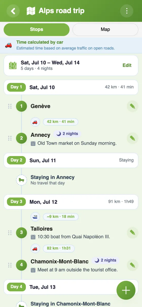
Departure date and nights at each stop: the app lays out the walk day by day, with dates.
- ⛰️
The climb of each leg
An elevation profile shows the ups and downs of every walking leg.
- 📏
Distances and times
On foot, distances and durations follow paths; the summary adds up the whole route.
- 📝
Shared notes
Water points, where to meet, the bus back: a note of up to 500 characters at each stop.
- 📤
GPX export
The full route as a GPX file for your GPS or hiking app.
Your walking route in YouTim
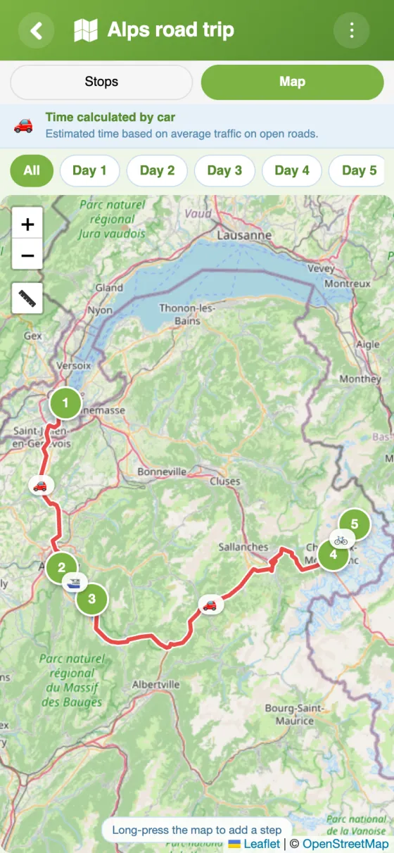
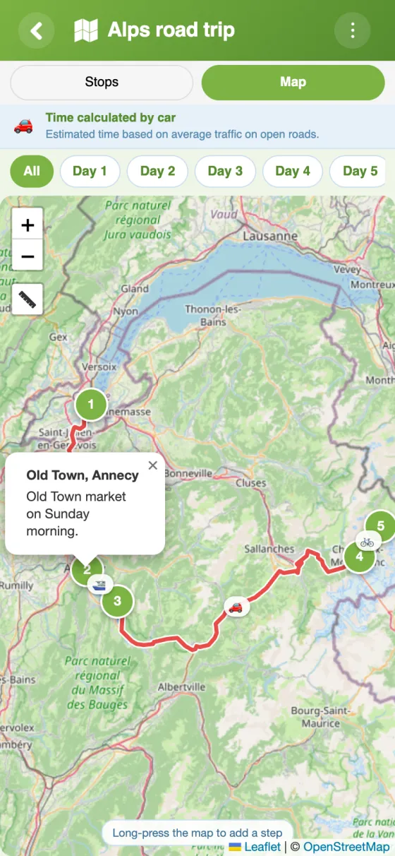
The stages with their distances, the route on the map and the details of each stop.
Map out a walking route in 5 minutes
A hiking route planner for walking together
A multi-day walk is planned around a map, but on the day everyone looks at their own phone. YouTim's Itinerary service gives the whole group the same route, the same stages and the same notes.
Creating a walking route, stage by stage
Add the stops in the order you'll walk them, then drag them around if the plan changes. With the by-day option, the planner sorts the stages from the departure date and the nights at each one, and shows each day's distance. On the map, one chip per day shows only that day's legs: handy the evening before, to look at tomorrow.
Plot a walking route with its elevation
On foot, each leg follows paths, with its distance and estimated duration. The elevation profile shows where the long climb is, which helps decide where to stop and whether a stage is too much for the slowest walker. The summary at the bottom of the list gives the total distance, the number of days and the number of nights.
A hiking trip planner for long-distance trails
The West Highland Way, a coast path, the Tour du Mont Blanc: put the huts or villages where you stop as stages, and use the note at each one for practical details (where to refill water, the bus back, who carries the stove). For the gear, keep a shared list in the same YouTim.
Out of signal, the app still shows the content last loaded. To follow the path itself, export the route as a GPX file and open it in your GPS or hiking app.
A free walking route planner for clubs and friends
The Itinerary service is free, with no ads and no in-app purchases, on iPhone, Android and the web. A walking club can keep the programme for the season in the same YouTim as its calendar and chat; see our clubs and teams page.
Frequently asked questions
Is the YouTim walking route planner free?
Yes, completely free, with no ads and no in-app purchases, on iPhone, Android and the web.
Can I see the elevation of a walk?
Yes: walking and cycling legs have an elevation profile that shows the climbs and descents.
Can I plan a trek over several days?
Yes. Turn on “Organise the trip by day”, set the departure date and the nights at each stop: the stages are sorted by day, with dates and each day's distance.
Can I load the route onto my GPS or hiking app?
Yes, the route exports as a GPX file, a format most GPS units and hiking apps can open.
Can I add practical details to a stage?
Yes, one note per stop, up to 500 characters. It shows under the stop's name and in its bubble on the map, for every member.
Can someone without an account see the route?
Yes, if an admin turns on “Share as view-only”: the person opens the link in a browser and sees the stages and the map, without being able to change them.
 YouTim
Your whole group in one place.